

Backcountry Avalanche Forecast Central Sierra Nevada
Sierra Avalanche Center
www.sierraavalanchecenter.org
- Issued
- Saturday, December 2, 2023 - 6:59AM
- Expires
- Sunday, December 3, 2023 - 6:59AM
- Author
- Brandon Schwartz
The Bottom Line
Areas where wind drifted snow has deposited into a cohesive slab near ridgelines remain the main avalanche concern for today. Gradual, incremental loading of new snow onto a very weak snowpack will increase concern for avalanches in wind protected areas over the next 24 hours. Travel with caution today. The snow cover is thin and shallow with many obstacles to hit.
Avalanche Danger
Saturday, December 2, 2023
Sunday, December 3, 2023
- Above Treeline2 - Moderate
- Near Treeline2 - Moderate
- Below Treeline2 - Moderate
 1 - Low | 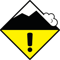 2 - Moderate | 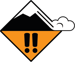 3 - Considerable |  4 - High |  5 - Extreme | |
|---|---|---|---|---|---|
| Travel Advice | Generally safe avalanche conditions. Watch for unstable snow on isolated terrain features. | Heightened avalanche conditions on specific terrain features. Evaluate snow and terrain carefully; identify features of concern. | Dangerous avalanche conditions. Careful snowpack evaluation, cautious route-finding and conservative decision-making essential. | Very dangerous avalanche conditions. Travel in avalanche terrain not recommended. | Extraordinarily dangerous avalanche conditions. Avoid all avalanche terrain. |
| Likelihood of Avalanches | Natural and human-triggered avalanches unlikely. | Natural avalanches unlikely; human-triggered avalanches possible. | Natural avalanches possible; human-triggered avalanches likely. | Natural avalanches likely; human-triggered avalanches very likely. | Natural and human-triggered avalanches certain. |
| Avalanche Size and Distribution | Small avalanches in isolated areas or extreme terrain. | Small avalanches in specific areas; or large avalanches in isolated areas. | Small avalanches in many areas; or large avalanches in specific areas; or very large avalanches in isolated areas. | Large avalanches in many areas; or very large avalanches in specific areas. | Very large avalanches in many areas. |
Avalanche Problems (2)
Problem #1: Wind Slab
Problem Type
Aspect/Elevation
Likelihood
Size
The combination of new snow and wind over the last 36 hours created slabs of denser snow along the downwind side of ridgetops. Drifting and depositing of new snow is expected to continue today and tonight, keeping this avalanche problem ongoing. In some areas, wind slabs may exist on top of a very weak, sugary (faceted) snowpack. Triggering lower on the slope than is common for a wind slab avalanche could easily occur anywhere a slab exists on top of a weak, faceted snowpack.
Use clues such as visible drifting snow, cornice formations, wind pillows, or other signs of snow distribution on the ground to identify areas that hold wind slabs. Exercise increased caution around areas where wind drifted snow has been deposited.
Problem #2: Persistent Slab
Problem Type
Aspect/Elevation
Likelihood
Size
Gradual, incremental loading of new snow onto a very weak snowpack is raising the concern for a persistent slab avalanche problem to develop mainly on NW-N-NE aspects. In more isolated areas, weak faceted snow also exists on E and W aspects. New snow amounts over the next 24 hours could load up to another 0.5 inches of SWE on top of the recent snow load of 0.2 to 0.4 inches of SWE that occurred Thursday night. There is a high amount of uncertainty here. With relatively smaller, incremental loads added over a few days, it is hard to know when the breaking point for the snowpack will occur.
Any snowpack collapses, whumpfing sounds, or shooting cracks encountered are signs of an unstable snowpack. If you are encountering any of these signs of instability, avoid NW-N-NE aspect avalanche terrain in the area.
Forecast Discussion
Throughout the forecast region, 1 to 2 feet of snow can be found on NW-N-NE aspects above 8000'. Continuous snow cover starts around 7,400' to 8,000' depending on location. The snowpack on NW-N-NE aspects is either rain crust under new snow, a mix of rain crusts and faceted snow, or all faceted snow and depth hoar depending on location and elevation. The presence of rain crusts generally decreases as elevation increases.
Previous NE wind events scoured the upper portion of many wind exposed slopes down to rock, dirt, and/or ice before the recent snowfall. Snow coverage and snowpack structure are highly variable throughout the forecast region. A much thinner snowpack or bare ground exists across E-SE-S-SW-W aspects.
Early season conditions exist with many obstacles (rocks, bushes, logs, open water, etc.) exposed or barely covered. Hitting one of these hazards could easily end your season before it even begins. If you are traveling on snow for recreation, you should come up with a daily travel plan based on the current conditions and associated hazards.
Mountain Weather
- Issued
- Saturday, December 2, 2023 - 7:05AM
- Author
- Brandon Schwartz
Another weather system is passing by to the north of the forecast area today. The far southern end of this weather system is expected to bring increased SW winds and snow showers to the forecast area now through tomorrow morning. Ridgetop winds are increasing in speed this morning. Light snow showers this morning are expected to increase in coverage early this afternoon. Snow level is forecast to slowly rise today and tonight with a more substantial jump up to 7,500' to 8,000' tomorrow morning. Total snow accumulation of 2 to 7 inches is expected over the next 30 hours. Areas along the Sierra Crest in the northern portion of the forecast area are expected to receive the most new snow accumulation from this weather event.
| Central Sierra Nevada | Conditions in the last 24hrs | Weather Forecast for Today Produced in partnership with the Reno NWS | Weather Forecast for Tonight Produced in partnership with the Reno NWS | Weather Forecast for Tomorrow Produced in partnership with the Reno NWS |
|---|---|---|---|---|
| Weather | Partly to mostly cloudy skies. | Mostly cloudy. Chance of snow showers. Snow levels 6000 feet. Chance of precipitation is 35%. | Mostly cloudy. Chance of snow showers. Snow levels 6500 feet. Chance of precipitation is 45%. | Mostly cloudy. Slight chance of snow showers in the morning. Snow levels 7500 to 8000 feet. Chance of precipitation is 20%. |
| Temperatures 7000 to 8000 ft. | @ 5am: 25 to 30 ° F | Max: 26 to 35 ° F | 32 to 37. ° F | 26 to 31. ° F | 39 to 44. ° F |
| Temperatures 8000 to 9000 ft. | @ 5am: 23 to 26 ° F | Max: 24 to 29 ° F | 28 to 33. ° F | 23 to 28. ° F | 35 to 41. ° F |
| Mid Slope Winds | W average 7 mph, max gust 23 mph. | Southwest 15 to 20 mph with gusts to 35 mph. | Southwest 15 to 20 mph with gusts to 35 mph. | Southwest around 15 mph with gusts to 30 mph in the morning becoming light. |
| Ridgetop Winds | W average 15 to 37 mph, max gust 60 mph. | Southwest 30 to 40 mph increasing to 30 to 50 mph in the afternoon. Gusts up to 75 mph. | Southwest 30 to 45 mph with gusts to 75 mph. | Southwest 20 to 35 mph with gusts to 60 mph. |
| Snowfall 7000 to 8000 ft. | 0 to trace | 90% probability of 1 to 4 inches. 10% probability up to 1 inch. | SWE = Up to 0.25 inch. | 80% probability up to 2 inches. 20% probability of 2 to 4 inches. | SWE = Up to 0.25 inch. | Up to 1 inch. | SWE = Less than 0.10 inch. |
| Snowfall 8000 to 9000 ft. | 0 to trace | 90% probability of 1 to 4 inches. 10% probability up to 1 inch. | SWE = Up to 0.25 inch. | 80% probability up to 2 inches. 20% probability of 2 to 4 inches. | SWE = Up to 0.25 inch. | Up to 1 inch. | SWE = Less than 0.10 inch. |
| Total Snow Depth between 8200 and 8700 ft. | 7 to 13 inches |
This information is provided by the U.S.D.A. Forest Service and describes general backcountry avalanche hazard and conditions.
It does not apply to ski areas and highways where avalanche mitigation is conducted.